Condensed Geology: Black Hills, South Dakota ![[Map] Black Hills [Map] Black Hills](../../web/worldmap.gif)
Geology of Black Hills is very similar to that of Colorado Rockies, only at smaller scale.
Condensed Geology: Black Hills, South Dakota ![[Map] Black Hills [Map] Black Hills](../../web/worldmap.gif)
Geology of Black Hills is very similar to that of Colorado Rockies, only at smaller scale.
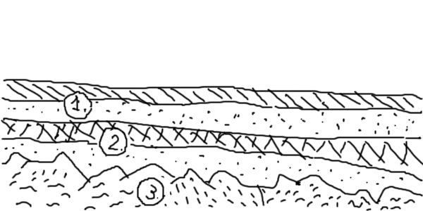
 Figure 1 70 MYA. Toward the end of Mesozoic era South Dakota is mostly flat. Mesozoic (1) and Paleozoic (2) sediments cover the Precambrian igneous and metamorphic basement (3). |
John Paul Gries Roadside Geology of South Dakota (Roadside Geology Series) Mountain Press Publishing Company, 1996, ISBN: 978-0-87842-338-5
© November 15, 2014, Yuri Wolf / YuriKira.com